This is a guest post from our mobile developer, Alan Paxton, about our forthcoming new iPhone app (which we've been able to do as a result of grants from the Rees Jeffreys Road Fund and Cycle Cambridge).
I'm going to be one of the people giving a 5-minute talk to Edinburgh Techmeetup tonight (http://techmeetup.co.uk/blog/). I will demonstrate the CycleStreets iPhone app I've been working on for a while now, and which is currently in test, planning for a release during Cycle Week. On that subject, I would be happy if anyone would volunteer themselves as a beta tester; I can't offer much of a reward beyond an honourable mention on this blog, or maybe in the app credits ? Get in touch if you'd like to try it out. I'm already checked in to techmeetup (at http://www.getbloop.com/)
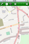
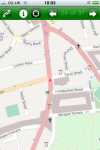
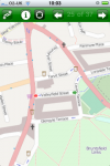
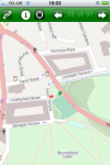
The slideshow is a demo of the app. The main features are:
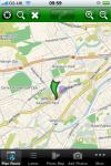
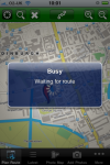
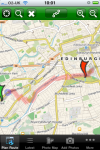
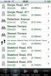
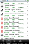
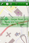
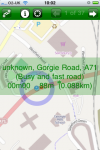
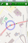
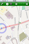
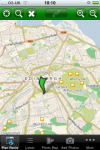
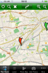
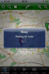
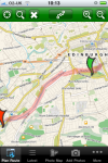
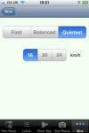
A Cycle Journey Planner which is aware of cycle paths and lesser trafficed roads. Of course, the journey planner is part of the core CycleStreets service, and as far as the app is concerned it's a routing black box. But that's the point.
You can use the GPS location to locate yourself on the map, and place a rout endpoint automatically.
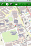
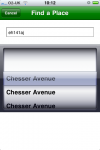
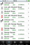
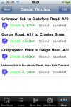
You can use the CycleStreets namefinder to look up towns, streets or postcodes and place a route endpoint there.
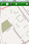
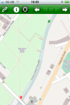
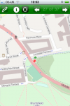
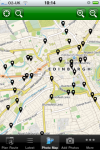
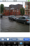
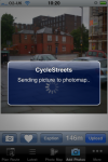
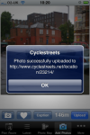
Photomap. This is a cycle campaigning and information tool that maintains a database of geotagged photographs relevant to the cycling infrastructure. Using the app, you can see photomap photos on the section of the map you're looking at, and you can upload photos to photomap direct from your iPhone.
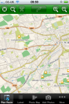
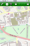
For those of you who are interested in this sort of thing, the app uses the RouteMe slippy maps library, accessing OpenStreetMap maps through the Cloudmade services. Although some of the features are not as slick as Google maps, it allows recent map tiles to be cached on the device, and generally does not suffer from tricky to understand licence niggles like the MapKit does. OpenStreetMap is a community mapping initiative, so if you're interested you can add insanely detailed mapping information for the POIs you know and love.


13 thoughts to “Cyclestreets iPhone App Beta”
i would be happy to test
paul
Will it work at all for iPod Touch? I realise there is no GPS to find the current positiona nd you would need to be in a wifi connection area, but it should still be possible to work out a route in advance and perhaps access it offline … ?
Yes, should be. Will check with Alan, but don't see why not.
Paul, if you supply me with a UDID, I can add you to the tester list.
One or two of the testers on my list have iPod touch, and we're going to see how they go, but yes it should be usable in the way you suggest.
Ohh I'd love to try out the app
Any chance of an Android version being developed?
hi alan,
just back from velo city
any news on the app?
I have sent you my udid
I'd be happy to beta test this if you still have some spaces and are looking for testers.
I would like to be a tester for the app. i'm new to london and use cyclestreets a lot to find my way around town as I learn the more bike friendly routes. This app would get a thorough testing from everyday usage. thanks.
Re an Android app: See our next blog posting: http://www.cyclestreets.net/blog/2010/06/09/mobile-app-funding/
Happy to be a tester for the app.
I will be happy to test it for you, I have tried to find it on my i phone but cannot find it, so presume it is not ready yet
Please let me know if you still need beta testers. I'm currently using Cyclemeter and Trails, but love the maps from CycleStreets.