This is a post for app developers. So it contains some techy stuff which probably won’t be of interest to our cycle routing users.
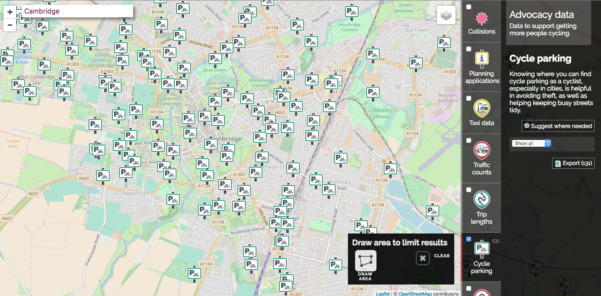
Knowing where you can find cycle parking as a cyclist, especially in cities, is helpful in avoiding theft, as well as helping keeping busy streets tidy.
By providing information on where cycle parking exists, developers of apps can easily help people find cycle parking before they even reach their destination.
CycleStreets provides a Cycle parking API as one of the points of interest (POI) types that can be retrieved in our extensive cycling API suite. Developers can embed this in our app – either by making realtime calls or obtaining the data en-batch using the CSV export mode.
You can see an example implementation on our new Bikedata website:
The API provides the following data:
- Locations of all cycle parking in the UK and other areas that we support (much of northern Europe and various cities around the world – contact us if you need other areas)
- Whether the parking is public or private
- Number of bikes that can be parked (where data is available)
- Details of whether the cycle parking is covered, what type of stands, etc. (where data is available)
- The location of the entrance point rather than the centre point (for larger installations, where data available)
- (Coming soon) Large areas of parking to be available as areas rather than (entrance) point
By default, all locations (whether public or private) come through, but you can specify a filtering option (as seen in the Bikedata example) if you wish.
We perform a range of pre-processing to enhance the raw data:
- If the location is on private land, but the parking itself is not marked as such, we pre-process the data to mark it as private
- For larger installations such as cycle parks, we use the entrance point as its location, rather than the centre-point
- We convert data defined as either points or areas into a unified set of points

This data is all possible thanks to the power of OpenStreetMap. We regularly import OSM data, perform a range of processing on it (e.g. convert locations on private land into private POIs, determining entrance points, etc.), and turn this into an indexed API.
Our API is a flexible, robust and well-maintained interface (it has been running since 2010). If you need a Service Level Agreement, or are likely to require high volumes of requests, we can also provide the API on a contractual basis.
To get started, just obtain an API key, and set your application to make API calls to the POIs API and render the GeoJSON response on your map.
If you would like to request any enhancements to the API, to cover your use-case, do get in touch.
Also, if you have any existing cycle parking data, we are happy to provide advice on how to make it available.