Our White label sites system allows organisations and companies to embed an active travel route planner into their websites easily.
You can see some examples of the system in use at these sites:
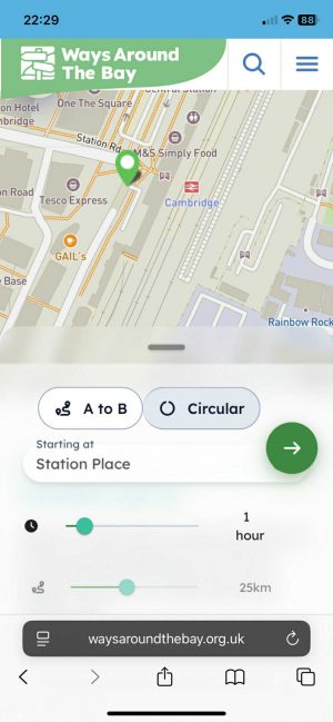
- Ways Around The Bay (Morecambe Bay) – Plan your route
- Suffolk On Board – Dare to explore
- Cumbria Travel Actively – journey planner
- Cycle Ashford – route planner


Today we launch the latest release. We’ve added/enhanced a range of useful features:
- A fresh new mobile-friendly interface
- 3D itinerary mode
- ‘How far can I travel from here?’ – travel isochrones
- E-bike routing
- Elevation display with scrubbable control
- Browsing curated routes as both map/card
- New POIs display
These enhance the main A-B routing, optional circular routing, multiple waypoints, choice of map display, curated routes, and various navigation features.
You can view our demo ‘Placeford’ site, with all features enabled.
 .
. 
A new, user-friendly mobile display with 3D mode.
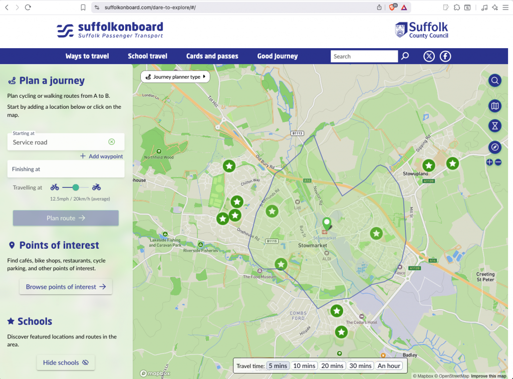
New isochrones feature – shows how far from a starting location you can travel.
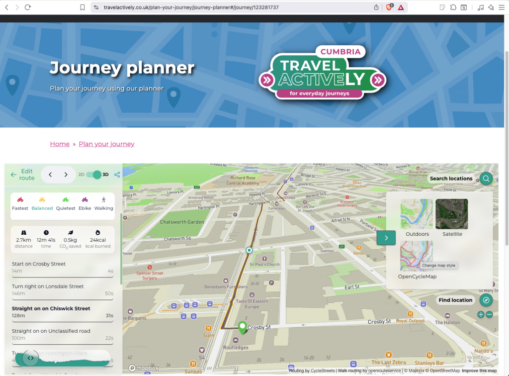
New 3D itinerary mode, with elevation display/scrubber.
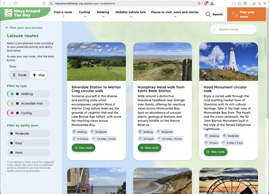
Improved curated routes system with various filters and map-based display option.
Details of the White label sites system can be found on the Gov.uk Digital Marketplace, where we are an approved supplier.
Do get in touch if you would be interested in an installation for your site.
It is very easy to get running in technical terms: we use the same method as embedding a YouTube video, and we provide a handy control panel to set up the options and styles you want.
The full feature list is:
- Attractive, fully-zoomable map
- Choice of background layers – outdoors / cycle map showing NCN and local routes / satellite
- Plan routes from A-B
- Route choices: quiet, balanced, fastest, e-bike, walking
- Draggable markers, multiple waypoints
- Turn-by-turn directions with clickable points
- CO2 saved and calories count included
- E-bike routing, not available on most other websites
- Walk routing built-in (optional extra)
- Isochrone distance
- Elevation display/scrubber
- Plan circular A-A routes by time/distance (optional extra)
- Points of interest, with a wide range of categories you can manage directly
- Browsable preset leisure routes with photos and descriptions
- Data from OpenStreetMap, on which we can provide optional training
- Mobile-friendly with 3D mode
- Quick links to frequent locations
- Print output
- GPX output for main route types
- Share buttons
- Permalinks to enable routes and other pages to be shared easily
- Data refreshed daily
One thought to “White label sites now with 3D itinerary and other features”
Pingback: weeklyOSM 807 – weekly – semanario – hebdo – 週刊 – týdeník – Wochennotiz – 주간 – tygodnik