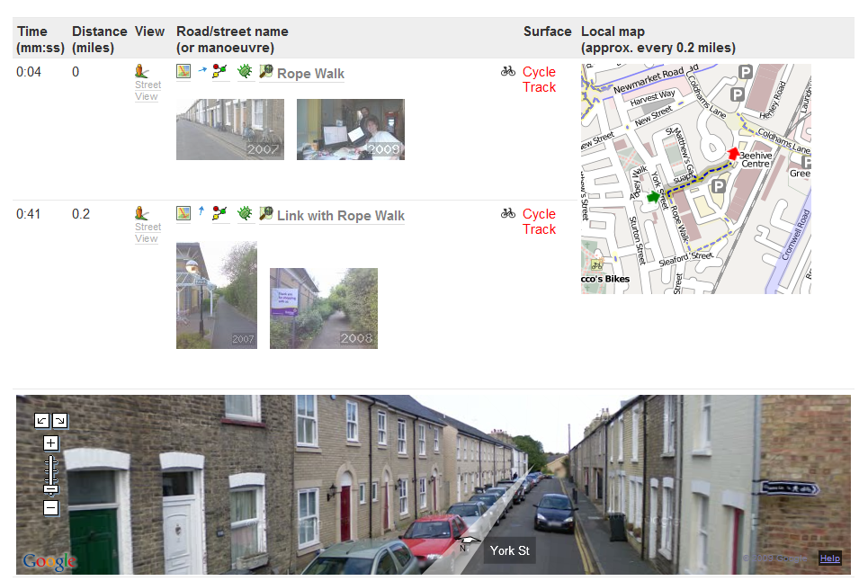
We’ve now added a Street View facility to the itinerary listing pages. We think this will really help people to visualise the routes planned in many urban areas.
Many thanks to George Coulouris, who wrote the main code to integrate this facility into CycleStreets.
To use it, just go to an itinerary listing, e.g. Itinerary 100,000 and click on the ‘Street View’ icon ![]() next to any segment of the route, and the Street View panel should open just below that point.
next to any segment of the route, and the Street View panel should open just below that point.
Please do use the feedback button to provide a bug report if it doesn’t work in your browser. It seems to be OK on FF3/IE8/Chrome but more testing is welcome.
The system uses Google Street View, which is limited to some urban areas only, although Google are gradually covering more areas .

4 thoughts to “View from the Street – in itinerary listings”
This is great – such a useful addition. But there’s one catch. When StreetView doesn’t have the right path, but something nearby, it shows that wrong path/road. It’s not immediately obvious that you’re looking at the wrong road/path.
Yes, I’ve started to notice that. I’ll point this out to George who wrote most of the code, and see if he has any suggestions. There’s also the issue that when the photo data isn’t available at all in the area, we aren’t disabling the links for StreetView; George I think was going to look to see if there was a way to check programatically whether photo data exists at a point.
The ‘wrong path’ problem isn’t easy to fix. The StreetView database doesn’t include any mapping data other than the geo coordinates of each image set. The Google server decides what is close enough to the position you have requested to be relevant. I guess we could try to ‘second guess’ the Google server by comparing the geo coordinates that it returns with our location.
Google have goofed on the second issue too. There is no way to ask their server whether there is a street view within a given rectangle. They have overlays tiles to show it on the map, but it would be incredibly laborious to ‘screenscrape’ the relevant tiles. Another way would be to send a query to Google for each point on a route before displaying the icon. That might be do-able.
I’ve noticed that Google have very recently added a huge amount of additional image data to Street View. In fact it now appears to cover almost every road in Britain, except for those that have been explicitly excluded following privacy objections, etc.
This means that for the vast majority of our routes, there will Street View images whenever the route is on a road (but probably not for off-road tracks). Perhaps we could distinguish the tracks at route generation time and omit the Street View icon.