We’re proud to announce that, not one, but two of our new projects are finalists in the Active Travel Challenge being run by Smart Dublin.
Smart Dublin brings together technology providers, academia and citizens to transform public services and enhance quality of life. The Challenge showcases how open data can be used to support and promote walking, cycling and being active – as an alternative to motorised travel.
We will be presenting the projects at the final Showcase event on 14th July 2021 – tickets are free, and the event is in webinar format.
1. Mapping Low Traffic Neighbourhoods
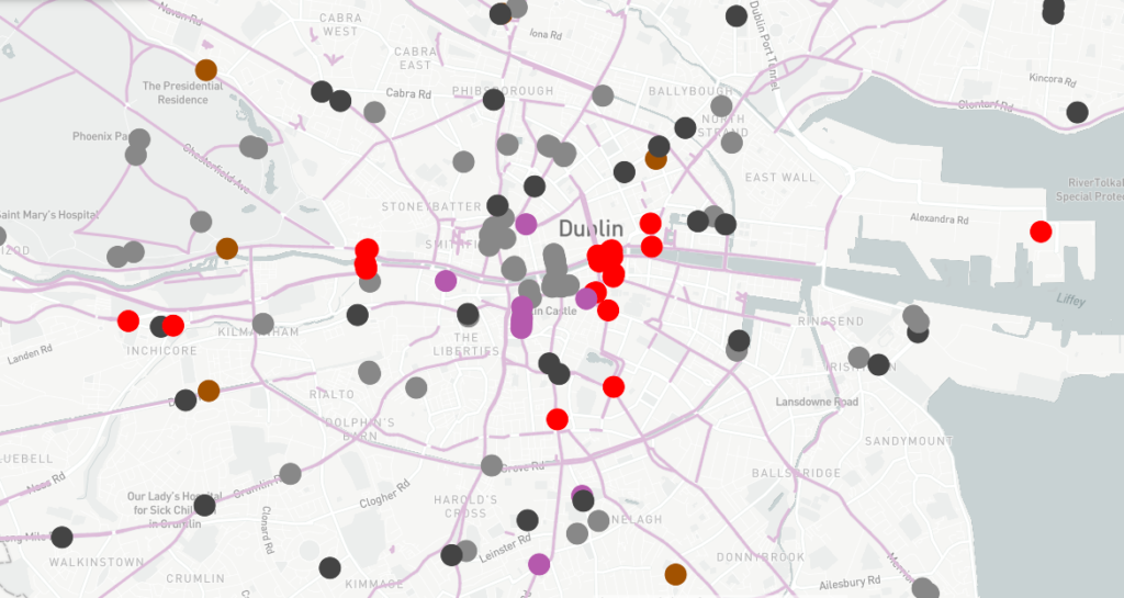
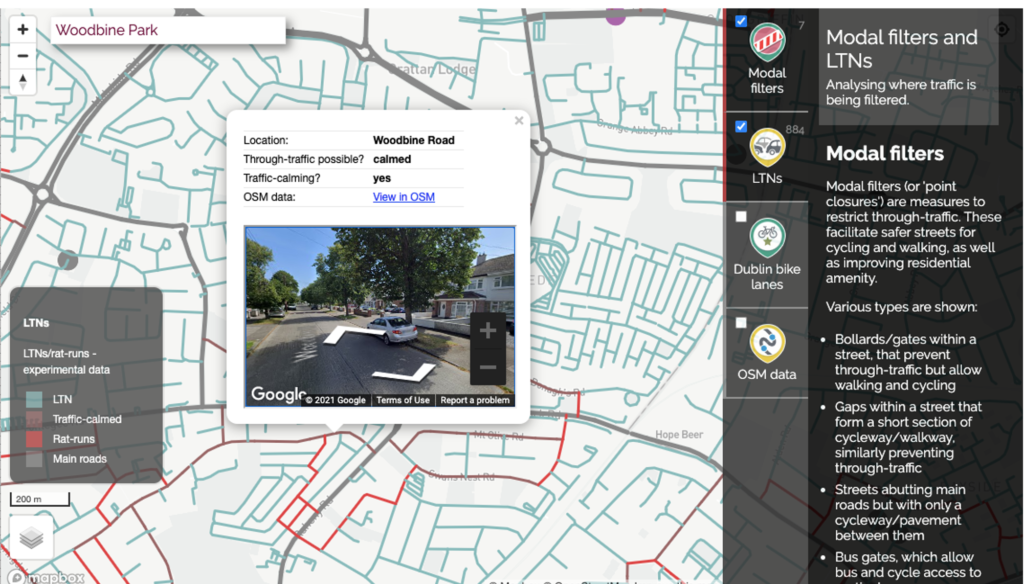
The first of our two projects, Mapping Low Traffic Neighbourhoods, aims to show the locations of modal filters, and low-traffic neighbourhoods.
Modal filters – measures such as bollards, gates, cycle contraflows, etc., are important ways to prevent motor traffic passing through residential areas. They have been much in the news recently, but are in fact very common, and have been created since at least the 1980s.
However, there is no national mapping data on where they are – either in Ireland or the UK. We have undertaken complex analysis of OpenStreetMap to determine the locations of modal filters. We also determine whether every street can be used for through-traffic (‘rat-running’) or not.
The resulting map will be helpful for anyone (e.g. citizens, councillors and council officials) trying to introduce new LTNs – as it proves how common and widespread these measures are. The data on streets will also enable new research to be undertaken on the socio-demographic effects of LTNs, for instance, whether they disproportionately benefit or affect particular groups.
Thanks to the Dublinked Open Data Portal, we have also been able to include locations of cycle lanes/tracks in Dublin as a clickable layer.
Stay tuned to our blog, as we will be reporting on this major new piece of research separately.
2. Widen My Path: Streetvisions
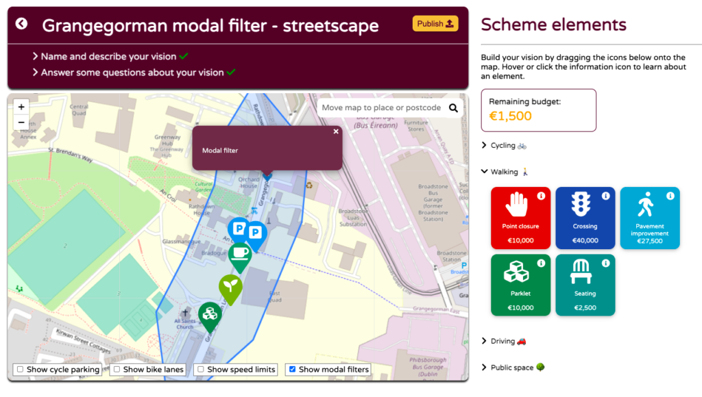
The second project that has reached the final of the Challenge is our Streetvisions project.
Last year we created Widen My Path, enabling members of the public to say where improvements to streets are needed in order to facilitate physical distancing and increasing levels of walking & cycling.
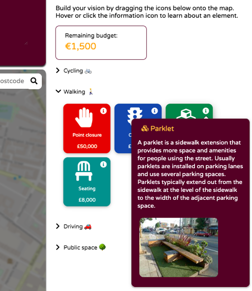
Our follow-up project, Streetvisions, is about enabling people to co-design transport and streetscape improvement schemes, setting out elements over a wider area in a cohesive manner, and iterating their vision of improvement based on feedback. Street redesign is often quite a top-down process. By contrast, Streetvisions aims to be a bottom-up tool.
People can construct their vision of how to improve an area, by dragging intervention types (e.g. cycle parking, seating, parklets, modal filters) onto the map. To help people be more aware of the constraints that local councils operate under, an indicative budget can be set, and the site provides explanations of each type of improvement.
As you can see from our screenshots below, the project has progressed significantly since we first reported on it in March. The site has now reached a beta level, and a full launch will take place shortly this summer.
Thanks to the Dublinked Open Data Portal, we have also been able to integrate various data sources that provide context – such as cycle parking and cycle lanes. We have also processed speed limit data from OpenStreetMap, and brought in our own modal filters data (see above!) as further contextual layers.
Header image © Dublinked.